

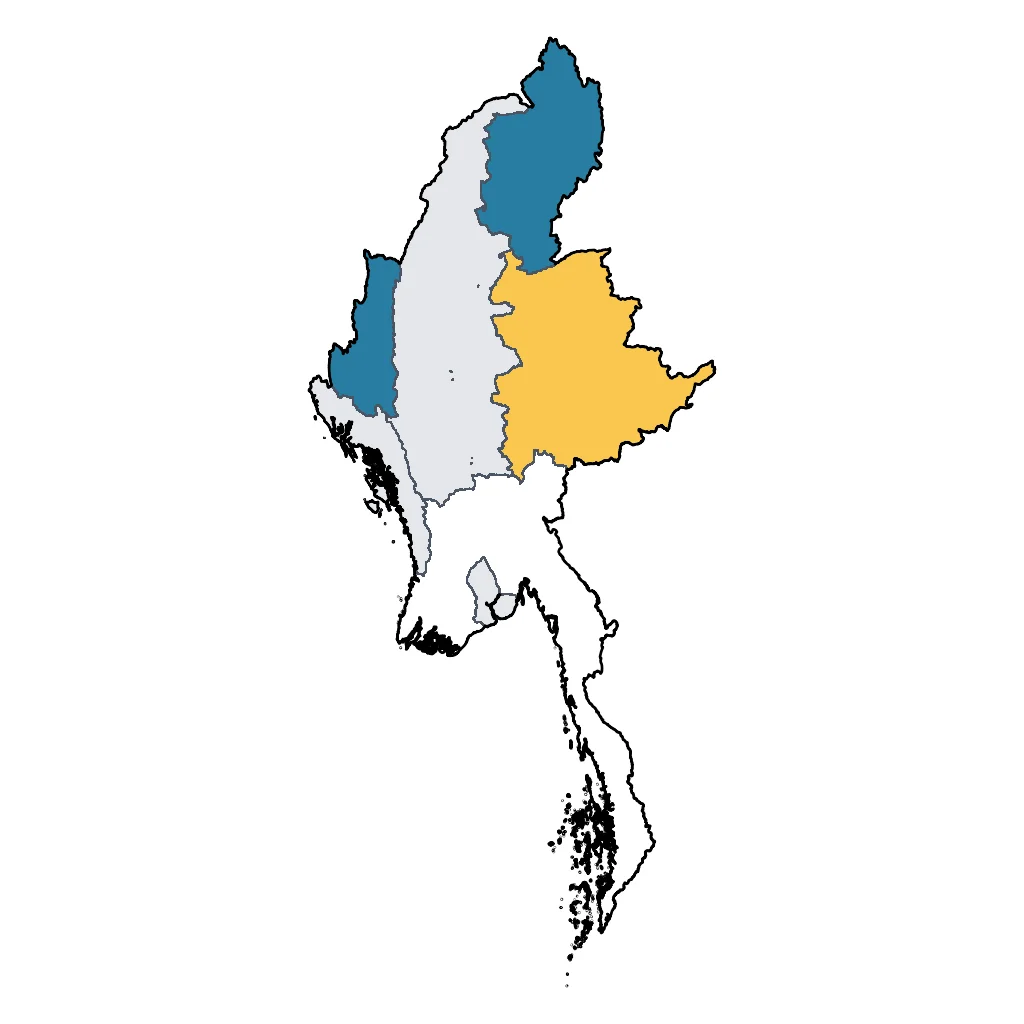
Chin & Kachin States (remote)
Rugged mountains and rich tribal traditions ⛰️
⚠️ SAFETY WARNING: Chin and Kachin States are currently active conflict zones with ongoing fighting between military forces and ethnic armed groups. Government agencies (CA, USA, UK, AU, IE, NZ) strongly advise to avoid all travel to these regions due to the high risk of violence, landmines, and kidnapping. Access is often restricted, and the security situation is extremely volatile. Families are strongly urged to consult their own government's official travel advisory before considering a trip, as circumstances and risk assessments vary.
In times of peace, these remote states represent the untamed frontier of Myanmar, characterized by dramatic topography and deep-rooted ethnic identities. Chin State, in the west, is a mountainous region known for its lack of commercial tourism. The primary attraction is Nat Ma Taung (Mount Victoria), which rises over 3,000 meters. The surrounding national park is an ecological haven, famous for native orchids and rare bird species. Hiking here is generally less strenuous than in the high Himalayas, making it accessible for active families who enjoy nature walks through pine forests.
Culturally, Chin State is famous for the older generation of women who bear intricate facial tattoos—a tradition that is now fading but remains a visible part of the region's living history. Visiting local villages requires sensitivity and respect, often best navigated with a local guide who can bridge the language gap. The hospitality in these remote hills is legendary, often involving warm welcomes in traditional wooden houses.
Kachin State in the far north is home to the source of the Irrawaddy River at the Myitsone confluence, a scenic spot popular for picnics. The capital, Myitkyina, sits in a valley and serves as a base for visiting the expansive Indawgyi Lake, a UNESCO Biosphere Reserve. The lake is a sanctuary for migratory birds and offers a tranquil setting far removed from the busy cities of the south. While travel here is challenging due to infrastructure, the reward is witnessing a side of the country that few outsiders ever see.
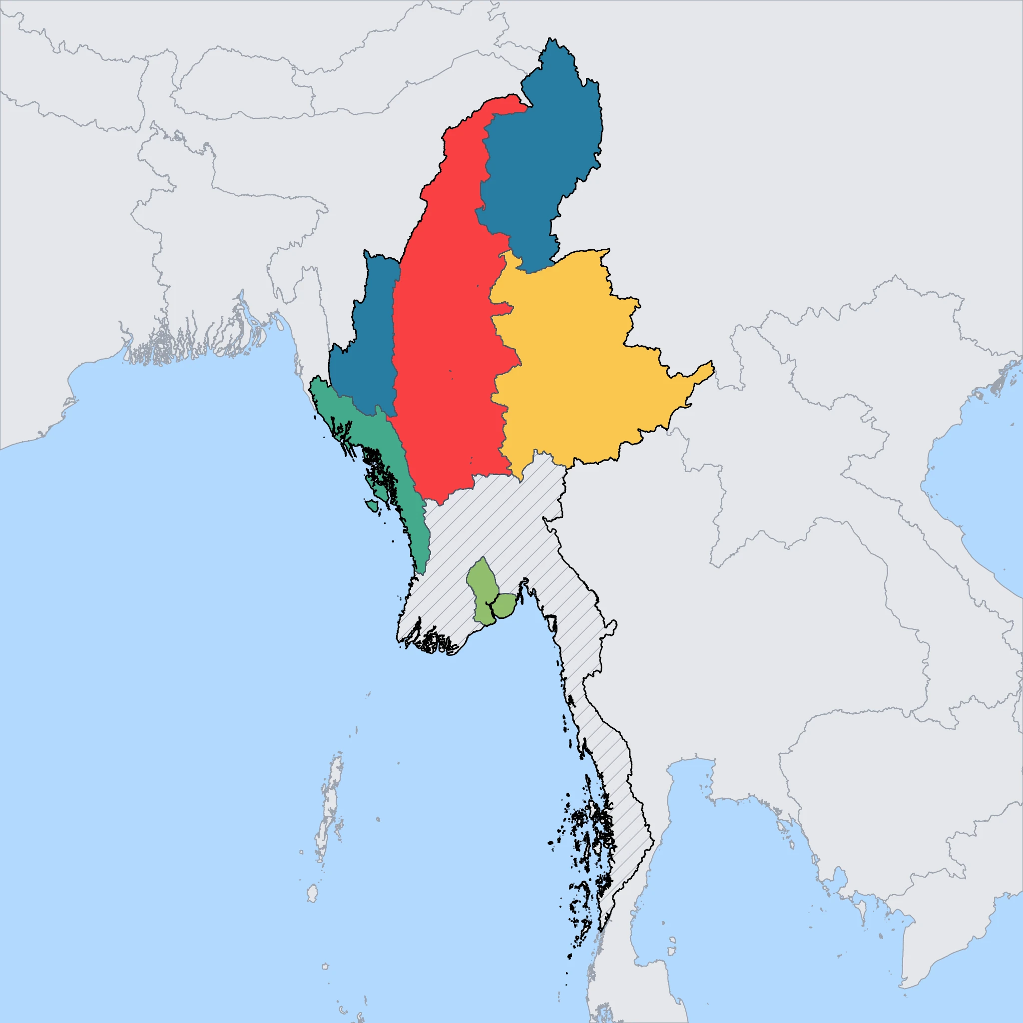
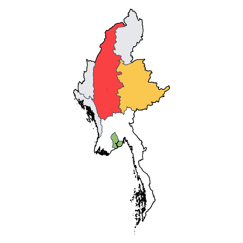
Click a region to explore

Activities & Best Times
Hiking, wildlife, outdoor exploration, ecotourism
A premier frontier for intrepid families, offering the Himalayan foothills and the unique biodiversity of Nat Ma Taung (Mt. Victoria) in a raw, authentic state. Dry winter months (Nov-Feb) provide optimal trekking conditions and clear vistas, while the extreme monsoon (May-Sep) makes the rugged terrain dangerous and inaccessible.

Urban tourism, museums, historical sites, architecture
No editorial attractions are listed for this region, meaning there is zero evidence to support the classification. While the ethnic cultural traditions of the Chin and Kachin peoples are fascinating, the region's extreme remoteness, lack of tourist infrastructure, and absence of verifiable attraction data make very_good unsupportable. good reflects genuine cultural interest tempered by access limitations and missing evidence.

Learning experiences, scientific sites, historical education
Provides exceptional ethnographic and botanical learning opportunities for sophisticated families interested in Southeast Asian history and rare ecosystems. Access to local experts and heritage sites is best during the dry months; the monsoon season's high rainfall (up to 586mm) makes field-based learning nearly impossible.


Events, celebrations, seasonal attractions
The Kachin Manau Festival in January is a world-class display of authentic ethnic tradition that draws sophisticated travelers seeking genuine cultural events. Outside of this period and a few smaller spring harvests, the region's extreme weather and lack of tourist infrastructure limit the appeal of seasonal travel.

Scenic drives, countryside tours, route-based travel
While road infrastructure is primitive, the scenic drives through the mist-shrouded Chin Hills offer world-class landscapes for travelers with private 4x4 arrangements. Travel is only recommended in the driest months for safety and visibility; the rainy season brings severe risks of landslides and impassable mud tracks.

Attractions (26 total)
Natural Feature / Scenic Site
Indawgyi Lake Wildlife Sanctuary
Mohnyin
One of the largest inland lakes in Southeast Asia, this UNESCO Biosphere Reserve features the iconic floating Shwe Myitzu Pagoda and diverse migratory birdlife.
Nat Ma Taung National Park
Kanpetlet
The highest peak in Chin State offers breathtaking panoramic mountain views and is home to rare alpine flora and unique bird species.
Bontala Waterfall
Matupi
A spectacular multi-tiered waterfall nestled deep in the Chin hills, known for its pristine natural beauty and cooling mountain spray.
Myitsone Confluence
Myitkyina
The scenic and culturally significant meeting point of the Mali and N'Mai rivers, which join to form the great Ayeyarwady River.
Rih Lake
Rihkhawdar
A striking heart-shaped natural lake located on the India-Myanmar border, surrounded by legend and scenic forested hills.
Science Museum / Natural History Museum / Discovery Centre
Kachin State Cultural Museum
Myitkyina
A regional hub for natural history and ethnography, featuring dedicated galleries on Kachin's geological wealth, including rare jadeite, amber fossils, and local flora.
Indawgyi Lake Wildlife Education Centre
Lonton
A discovery center providing interactive exhibits on the unique biodiversity and endemic species of the Indawgyi Lake UNESCO Biosphere Reserve.
Road Trips & Scenic Drives
Mindat-Kanpetlet Scenic Road
Mindat
65km narrow paved mountain road (3-4 hours) traversing the ridges of the Chin Hills. This route connects the two main gateways to Nat Ma Taung (Mount Victoria) National Park, offering panoramic views of the surrounding valleys, traditional Chin tribal villages, and dense forests filled with rhododendrons and pine trees.
Visit website →Kalay-Hakha Mountain Highway
Kalay
130km winding mountain highway (6-8 hours) ascending from the plains of Sagaing into the high peaks of the Chin Hills. The road is fully paved and features dramatic switchbacks with a vertical gain of over 1,500 meters. Highlights include the 'S' curves near Falam and expansive views of the Manipur River valley.
Visit website →Myitkyina to Indawgyi Lake Route
Myitkyina
175km paved but bumpy road (5-6 hours) through the heart of Kachin State. The journey passes through tropical teak forests and rural agricultural landscapes before arriving at Indawgyi Lake, Southeast Asia's largest inland lake and a UNESCO Biosphere Reserve. Key highlights include the crossing of the Irrawaddy River and the scenic approach to Shwe Myitzu Pagoda.
Visit website →Historic Town / Village / Cultural Area
Myit-son (Ayeyarwady Confluence)
Myitkyina
The sacred birthplace of the Ayeyarwady River where the Mali and N'Mai rivers converge, holding deep cultural and symbolic meaning for the Kachin people.
Shwe Myit Zu Pagoda
Indawgyi Lake
A stunning gold-gilded floating pagoda on Indawgyi Lake, serving as the spiritual heart for the Shan-ni people and a major pilgrimage site.
Hsu Taung Pye Pagoda
Myitkyina
A prominent and beautifully maintained riverside pagoda that serves as a center for religious life and offers panoramic views of the Ayeyarwady River.
Kanpetlet Cultural Area
Kanpetlet
The gateway to Nat Ma Taung National Park, known for its preservation of traditional Chin village life and its scenic, cool-climate mountain setting.
Mindat Cultural Area
Mindat
A high-altitude cultural hub offering insight into the traditional customs, unique facial tattoos, and mountain heritage of the Southern Chin ethnic groups.
Landmark / Monument / Iconic Urban Attraction
Nat Ma Taung (Mount Victoria)
Kanpetlet
Families can explore the highest peak in Chin State, known for its rare orchids and stunning panoramic views within a protected national park.
Rih Dil
Rihkhawdar
A serene, heart-shaped natural lake located near the Indian border that provides a picturesque setting for family walks and photography.
Kachin Manau Grounds
Myitkyina
Families can visit this vibrant urban park to see the towering, traditional Manau poles that serve as the center for Kachin cultural celebrations.
Hiking & Cycling Routes
Nat Ma Taung (Mount Victoria) Summit Trail
Kanpetlet
10km moderate day hike from the '10-mile' base camp to the summit. Typically takes 4-5 hours with an elevation gain of approximately 600m. The trail passes through rhododendron forests and offers panoramic views of the Chin Hills. Guide services are available in Kanpetlet.
Visit website →Putao to Mulashidi Bridge Hike
Putao
14km easy-to-moderate day hike or cycle following the Nam Lang River. Takes approximately 3-4 hours on foot with minimal elevation gain. The route leads to the iconic Mulashidi suspension bridge. Mountain bike rentals are available through Putao Trekking Adventures (putaotrekkingadventures.com).
Visit website →Indawgyi Lake Cycling Loop
Lonton
90km moderate-to-challenging cycling route encircling Myanmar's largest lake. Mostly flat but with unpaved, muddy sections; takes 1-2 days depending on fitness. Elevation gain is minimal. Bicycle rentals are available at the Indawgyi Wetland Education Centre in Lonton village.
Visit website →Mindat to Kanpetlet Cultural Trek
Mindat
55km challenging multi-day trek (typically 3-4 days) through the Chin mountain range. Total elevation gain exceeds 2,500m. The route connects remote ethnic Chin villages. Equipment and local guides are required and can be arranged in Mindat via local guest houses.
Visit website →Castle / Palace / Historic Site
Shwe Myitzu Pagoda
Hopin
A historic floating pagoda located in the center of Indawgyi Lake, appearing to drift on the water during the high-water season.
Kachin Manao Park
Myitkyina
The central cultural and historic site of the Kachin people, featuring tall, brightly decorated Manaw poles used for traditional ancestral festivals.
Natural Hot Spring / Thermal Bath / Historic Bathhouse
Kone Law Hot Spring
Waingmaw
Natural geothermal pools with temperatures averaging 45°C. The site features several concrete-lined public bathing basins and smaller private cubicles. The mineral-rich water is locally valued for its therapeutic properties and skin-healing benefits. It is a standalone destination popular with residents and visitors from nearby Myitkyina.
Maingna Hot Spring
Myitkyina
A public geothermal spring located near the banks of the Irrawaddy River. The facility provides outdoor concrete pools fed by natural sulfurous thermal water. It is a traditional gathering place for bathing and relaxation, offering a rustic experience centered on the natural heat of the mineral springs.