
Fiordland (Milford Sound)
Where waterfalls tumble from the clouds 🌧️🏔️
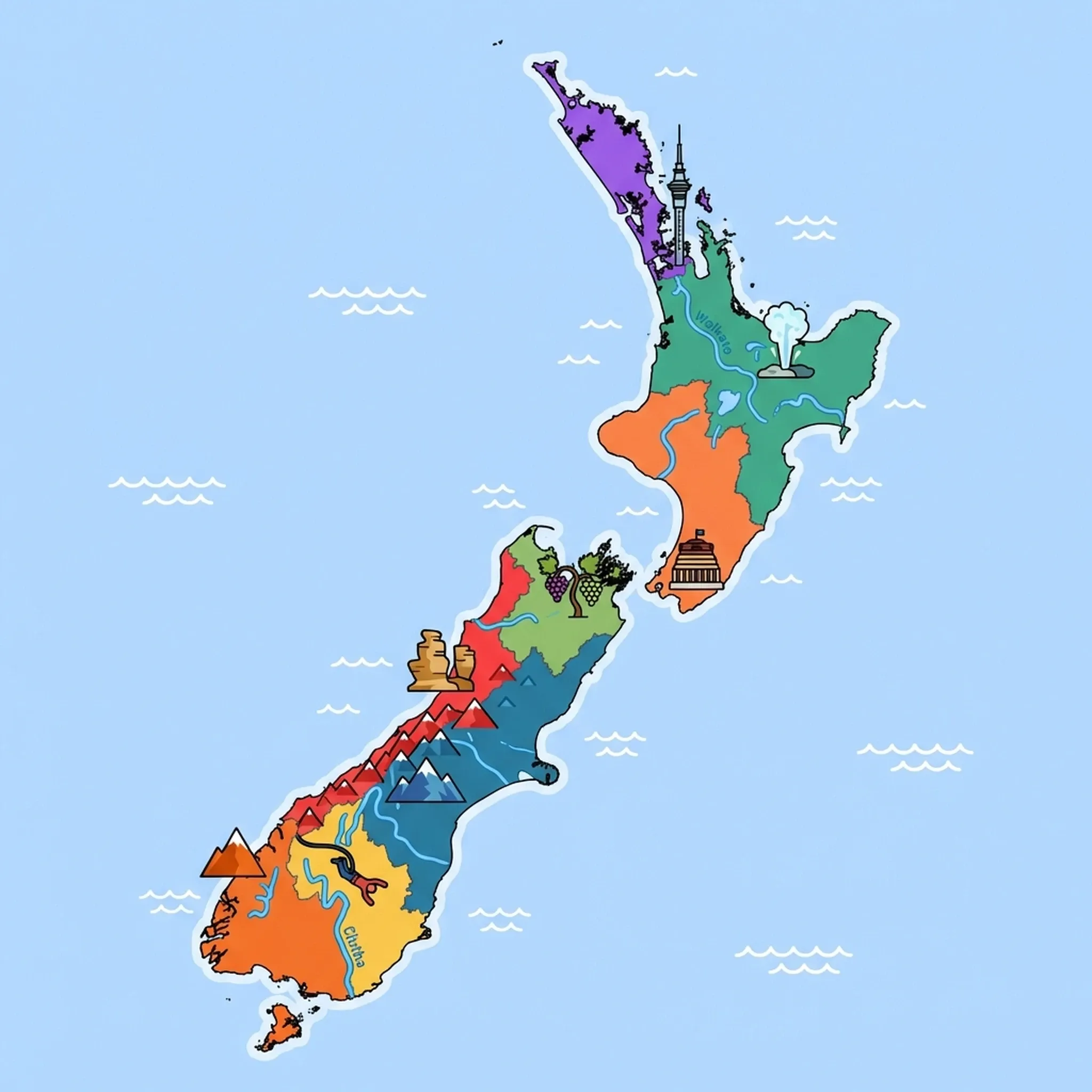
Click a region to explore
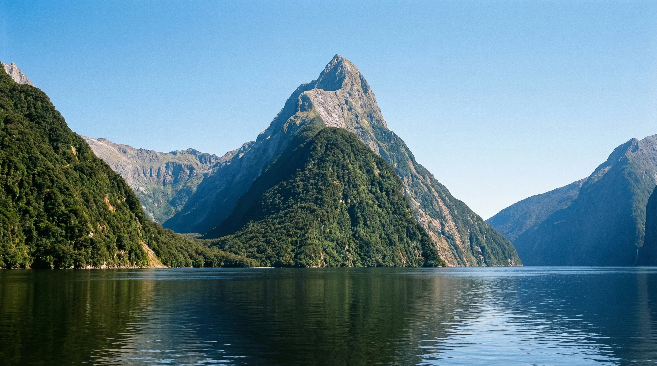
Fiordland is a place where nature rules supreme. It is one of the wettest places on Earth, but this rainfall is exactly what makes it so majestic, creating thousands of temporary waterfalls that cascade down sheer granite cliffs. The scale of the landscape here is difficult to comprehend until you are standing in it; mountains rise vertically from the sea, and ancient rainforests drip with moss and lichens. For children, it feels like stepping into a dinosaur movie. The region is largely untouched wilderness, part of a UNESCO World Heritage site, yet it remains accessible through the gateway town of Te Anau and the spectacular road to Milford Sound.
Te Anau is the base camp for all adventures here. It sits on the edge of a massive lake and offers a calmer, more grounded experience than the bustle of Queenstown. From here, families can venture into the national park. The journey is as important as the destination; the drive along the Milford Road is arguably the most scenic in New Zealand, passing through the Homer Tunnel—a rough-hewn passage through solid rock that kids find thrilling. While the environment is rugged, the infrastructure is excellent, making it safe for families to explore deep into the wilderness. Whether it's spotting a Kea (the world's only alpine parrot) tearing rubber off a car antenna or feeling the spray of a waterfall on a boat cruise, Fiordland offers tactile, unforgettable encounters with nature.
Key Attractions
The crown jewel is undoubtedly Milford Sound (Piopiotahi). A boat cruise here is essential; the boats get right under the waterfalls (expect to get wet!) and often spot seals basking on the rocks. The view of Mitre Peak rising from the dark waters is iconic. For a deeper wilderness experience, Doubtful Sound (Patea) is larger and quieter, though it requires a boat-and-bus journey to reach, which might be long for toddlers but excellent for older kids.
Back in Te Anau, the lake itself is a major attraction. Families can take a boat across Lake Te Anau to see the shimmering glowworm caves, a magical underground experience. For active families, the Kepler Track offers accessible day-walk sections through beech forest that look straight out of a fantasy novel. The Fiordland National Park Visitor Centre in Te Anau is also worth a visit to learn about the takahe, a rare flightless bird redisocvered in these mountains.
Practical Advice
It rains here—a lot. Embracing the rain is part of the experience. The best time to visit is summer (December–February), but even then, temperatures are cool (10–18°C). The sandflies (biting midges) are notorious; always carry strong insect repellent.
Food & Drink
Typical meal times: Dinner is early, 6:00 pm to 8:00 pm. Many kitchens in Te Anau close by 8:30 pm or 9:00 pm.
Typical meal costs: Te Anau has limited options, so prices are slightly higher. Pub meals NZ$30–45 (approx. $18–27 USD / €16–25 EUR). A family dinner costs NZ$120–160 (approx. $72–95 USD / €65–88 EUR).
Dietary requirements: Vegetarian and gluten-free options are standard in Te Anau cafes. On boat cruises, special dietary meals must be pre-booked.
Signature dishes:
- Venison – Wild deer is abundant in the region; look for venison pies or medallions in local restaurants.
- Crayfish (Rock Lobster) – Fiordland's coast is famous for them; expensive but delicious, usually served simply with lemon and butter.
- Cheese Rolls – A Southland classic; rolled bread with a cheese and onion mix, toasted until golden.
Why this score?
This is one of the wettest and most rugged wilderness areas on Earth, dominated by deep fjords and sheer mountain walls. Families can access the world-renowned Milford and Kepler Tracks, which offer significant physical challenges and remote environments. The lack of cell service in many areas and the scale of the landscape provide a genuine sense of isolation and adventure.
Why this score?
Medical facilities are extremely limited, with only basic clinics available in the gateway town of Te Anau. There are no hospitals within the national park, and the nearest major facilities require a lengthy drive or expensive helicopter evacuation to Invercargill or Dunedin. Tourists are advised to carry personal first-aid kits and travel insurance for emergency transport.
Why this score?
Milford Sound is arguably New Zealand's most iconic landmark, drawing massive numbers of international day-trippers from Queenstown. However, the region has very low permanent resident numbers and limited overnight accommodation, keeping its total popularity score lower than major urban centers. Its status is based on concentrated, high-volume transit tourism rather than prolonged stays.
Remote logistics make this an expensive region. Accommodation in Te Anau is pricey in summer, often NZ$250+ (approx. $150 USD / €140 EUR) for a motel unit. Milford Sound cruises range from NZ$60–150 (approx. $36–90 USD / €33–83 EUR) per adult, though kids often go free or half-price.

Getting Here & Around
Getting Here
- Driving – The primary route is State Highway 94 from Queenstown (2 hours) or Invercargill (2 hours). The Milford Road (State Highway 94) from Te Anau to the sound takes 2 hours but allow 4 for stops.
- Bus – Numerous coach tours run daily from Queenstown to Milford Sound (Piopiotahi), removing the stress of driving the winding alpine roads.
- Airports – Queenstown (ZQN) is the nearest major airport. Te Anau has a small airport for charter flights.
Getting Around
- Car – Essential for flexibility. There is no public transport to trailheads. Fill up with fuel in Te Anau; there are no gas stations between Te Anau and Milford Sound.
- Boat – Water taxis and cruises are the only way to see the fiords.
- Walking – The only way to see the deep bush. Tracks like the Routeburn Track are world-famous.
Nearby Airports (1 airport)
Invercargill
IVCInvercargill
View full flight map for New Zealand →
Official Links

Packing List
Sandflies are intense and relentless near water; natural remedies rarely work here.
Rain comes sideways; jeans will get soaked instantly on boat decks or short walks.
To keep cameras and spare clothes dry during the inevitable downpours on boat cruises.
There is zero mobile phone coverage on the Milford Road or at Milford Sound.
Essential for 'sandflies' (biting midges) in the South Island, which are immune to natural repellents.
The ozone layer is thin here; burn times are 10-15 mins. European/US sunscreens often aren't strong enough.
Single-use plastic bags are banned in all supermarkets and shops. Bring lightweight foldable ones.
Roads are exceptionally winding and hilly, often causing car sickness even in those who rarely suffer from it.
Weather changes instantly ('four seasons in one day'). A light rain shell is vital even in summer.

Activities & Best Times

Hiking, wildlife, outdoor exploration, ecotourism
A UNESCO World Heritage wilderness featuring the globally iconic Milford Sound and premier multi-day trekking routes. The peak season aligns with the 'Great Walks' operational window when tracks are safe and weather is mildest.

Scenic drives, countryside tours, route-based travel
Notes describe Milford Road as 'one of the world's most spectacular alpine drives' - this is internationally famous and deserves very_good despite being a single route. The rating should reflect quality, not quantity.

Beach resorts, marine activities: diving, snorkelling, kite surfing, wind surfing, sailing
Focuses on fjord cruises and sea kayaking in Milford and Doubtful Sounds rather than traditional resorts. Peak summer months offer the most manageable water temperatures and calmer conditions for marine exploration.

Urban tourism, museums, historical sites, architecture
Centered on world-famous natural landmarks and heritage sites like Mitre Peak and the Homer Tunnel rather than urban life. Summer provides the long daylight hours and visibility essential for appreciating these monumental cultural icons.

Learning experiences, scientific sites, historical education
Features significant natural history museums and a unique underwater observatory focused on fjord ecology and rare black corals. Facilities are most reliably accessible during the primary tourism season from spring through autumn.

Sport tourism, fitness activities, active recreation
Defined by internationally recognized hiking infrastructure including the Milford and Routeburn tracks. The season is strictly limited to the Great Walks window (Oct-May) to ensure safety and access to essential trail facilities.

Attractions (12 total)


Public Holidays & Calendar Next 12 months
Public holidays, festivals, cultural celebrations, and seasonal natural phenomena coming up in Fiordland (Milford Sound) over the next 12 months.
Loading holidays and events...

Travel Advisory
All major international agencies categorize New Zealand as a low-risk destination where standard safety awareness is sufficient for travellers.
Safety Topics
Traveller Advice (4 groups)

Outdoor conditions and alpine weather can change violently and without warning. Hikers (trampers) should register their plans with the Department of Conservation and carry a Personal Locator Beacon (PLB) when heading into remote areas.

Ensure you have a valid NZeTA or visa before departure. Complete the digital New Zealand Traveller Declaration (NZTD) prior to arrival. Comprehensive travel insurance is highly recommended even with reciprocal healthcare agreements.

The social and legal environment is highly inclusive, with no specific safety warnings for sexual or gender minorities.

While generally safe, solo female travellers should follow standard safety protocols and remain vigilant when out at night in less populated urban areas.
Agency Summaries
Safety conditions are comparable to Australia. Travellers must complete the mandatory New Zealand Traveller Declaration (NZTD) before arrival. There is a noted increased risk of measles, and visitors are encouraged to be up-to-date on vaccinations.
Standard vigilance is recommended. Visitors must obtain a New Zealand Electronic Travel Authority (NZeTA) before arriving. Practical advice focuses on emergency contacts and precautions against petty theft.
Travellers should maintain standard safety awareness. Key concerns include petty crime like pickpocketing in urban and tourist areas, as well as natural hazards such as seismic and volcanic activity. The terrorism threat level is monitored but considered a general risk.
The country is considered safe for travel with standard precautions. Information is provided regarding volcanic hazards, specifically at Whakaari/White Island, and geological monitoring through local services like GeoNet.
No major travel warnings are in place. The advice highlights environmental risks such as tsunamis and earthquakes, alongside strict biosecurity regulations and entry requirements for British nationals.
Information is provided for general guidance only and does not constitute travel, safety, medical, or legal advice. Conditions may change. Users are responsible for independently verifying information before travel.