
Showing 8 attractions · Sorted by importance

Alishan Highway (Provincial Highway 18)
📍 Chiayi City
🚗 Road Trip89km paved mountain road (2.5-3.5 hours). This iconic route ascends from the plains of Chiayi to the 2,200m peaks of Alishan. Highlights include the Eryanping tea terraces in Xiding, the mist-shrouded cedar forests of Fenqihu, and panoramic views of the Sea of Clouds. Well-maintained asphalt with significant elevation gain and frequent fog.

New Central Cross-Island Highway (Tataka Route)
📍 Alishan
🚗 Road TripApprox. 70km paved high-altitude section of Provincial Highway 21 (2 hours). This route connects Alishan to Sun Moon Lake via Tataka, the highest point accessible by road in this region. Highlights include the Yushan (Jade Mountain) lookout, the historic Husband and Wife Trees, and sightings of Formosan macaques in alpine forests.

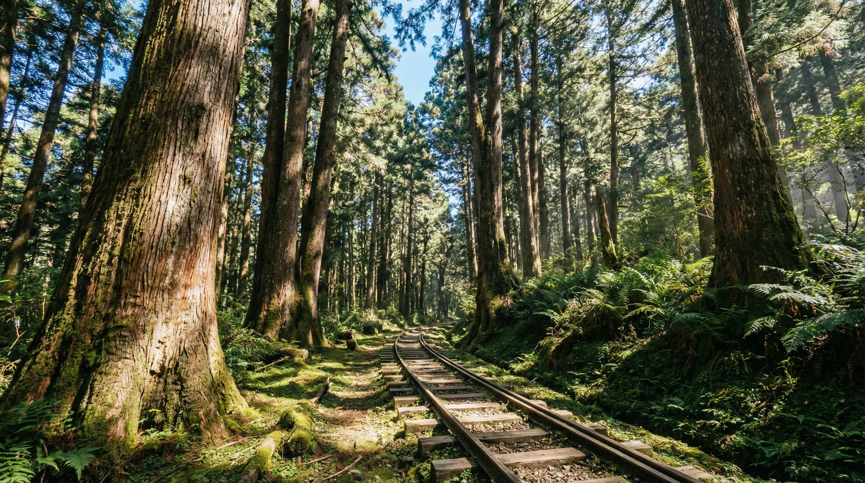
Mianyue Line Railway Trail
📍 Alishan Township
🥾 Hiking & Cycling9.2km moderate 6-hour trek with minimal elevation gain but significant hazards. This abandoned railway line features 14 tunnels and 24 bridges. Note: Requires a permit for the Taiwan Pleione Nature Reserve. Equipment/supplies available in Chiayi City; bike rentals: Giant Bicycles Chiayi (giant-bicycles.com/tw).
Tefuye Ancient Trail
📍 Alishan Township
🥾 Hiking & Cycling6.3km moderate 4-hour hike with 500m elevation gain. This trail follows an old logging railway through dense forests of cypress and cedar. The path is relatively flat for the first half, following the abandoned tracks. Bike rental for the surrounding Chiayi area: Giant Bicycles Chiayi (giant-bicycles.com/tw).
Eryanping Trail
📍 Fanlu Township
🥾 Hiking & Cycling1.1km moderate 1-hour hike with 150m elevation gain and steep wooden boardwalk sections. Famous for its views of terraced tea plantations and the sunset over the Sea of Clouds. Located at the 52.8km mark of Highway 18. Popular with road cyclists climbing the Alishan Highway.
Mt. Tashan Trail
📍 Alishan Township
🥾 Hiking & Cycling3.5km (7km round trip) challenging 5-hour hike with 600m elevation gain. This is the highest peak in the Alishan range, offering views of the 'Sea of Clouds' and the Central Mountain Range. The trail starts near the Sisters Pond in the Alishan Forest Recreation Area.

Taiping 36 Bends (County Road 162a)
📍 Meishan
🚗 Road Trip13km paved mountain pass (30-45 minutes). Famous for its 36 numbered hairpin turns that climb sharply from Meishan to Taiping Village. The route features markers for each bend and offers sweeping views of the Chianan Plain. It terminates near the Taiping Cloud Bridge, the highest-altitude scenic suspension bridge in Taiwan.