
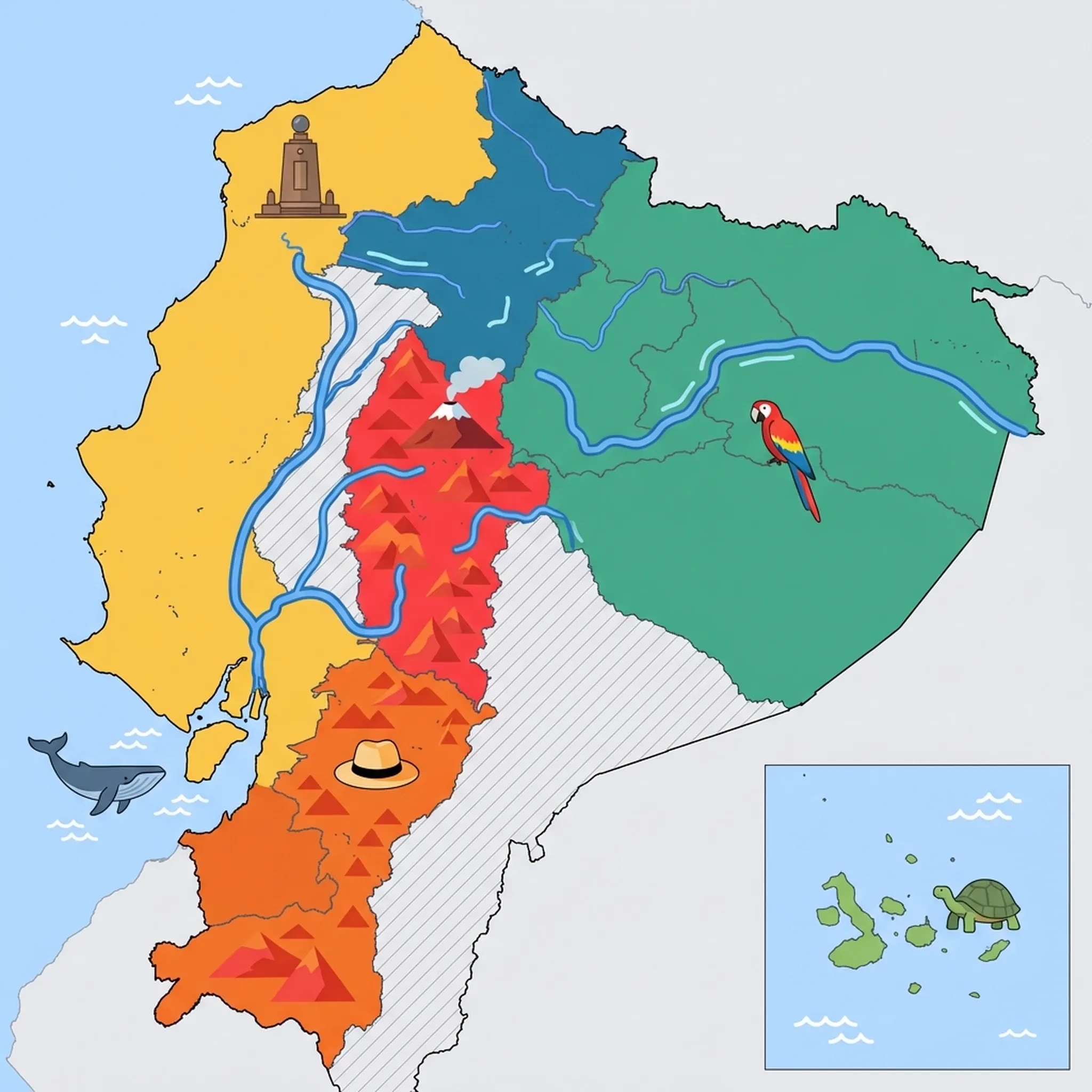
Click a region to explore
Overview
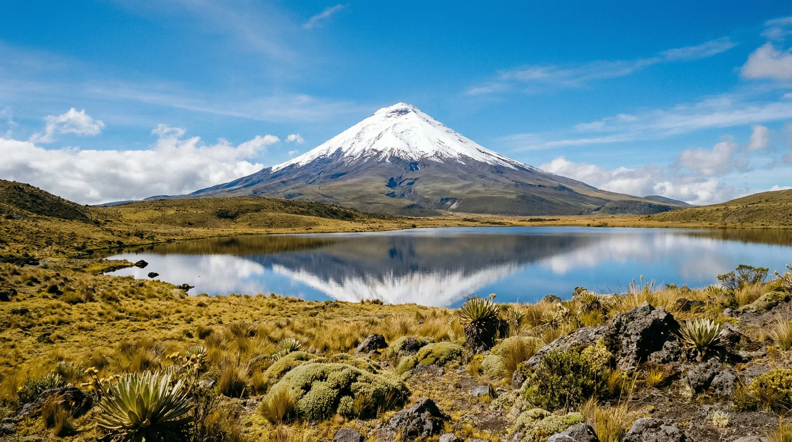
The Avenue of Volcanoes is arguably one of the most scenic road trips in South America. Stretching south from Quito, this valley is flanked by two parallel cordilleras of the Andes, offering constant views of massive volcanic peaks. For families, the scale of the landscape is humbling—children are often awestruck by seeing snow on the equator. The region is a patchwork of colorful quinoa fields, indigenous markets, and haciendas that have been converted into family-friendly hotels.
The town of Baños de Agua Santa acts as the region's adrenaline capital but is surprisingly kid-friendly. It sits in a transition zone between the Andes and the Amazon, offering a milder climate and lush vegetation. Here, families can rent bikes to explore the "Route of the Waterfalls," ride cable cars across gorges, or relax in thermal pools. It's an outdoor playground where the geography itself provides the entertainment.
Key Attractions
The star is undoubtedly Cotopaxi National Park. Even if you don't climb the summit, the paramo (highland moor) is perfect for easy walks around Limpiopungo Lagoon to spot wild horses and Andean gulls. Further south, the Chimborazo Wildlife Reserve offers a chance to see vicuñas (wild relatives of llamas) against the backdrop of Ecuador's highest mountain. For a wet and wild adventure, the Pailon del Diablo (Devil's Cauldron) waterfall in Baños features suspension bridges and stairs that let you get close enough to feel the spray—a thrilling experience for older kids.
Practical Advice
Altitude is a factor here; many areas sit above 2,800m (9,000 ft). Keep children hydrated and plan for slower walking paces. The best weather is generally June to September. Mornings are often clear, with clouds rolling in by afternoon, so start activities early.
Food & Drink
Typical meal times: Lunch is the main event, served 12:00 pm to 2:00 pm. Dinner is often lighter, around 6:30 pm to 8:00 pm.
Typical meal costs: $5–12 USD (approx. €4.50–11 EUR / £4–9.50 GBP) for standard meals; historic haciendas charge $20–35 USD (approx. €18–32 EUR / £16–28 GBP).
Dietary requirements: Potatoes and corn are staples. Gluten-free is relatively easy if you stick to whole foods, but cross-contamination in fried foods is a risk. Vegetarian options are common (cheese, avocado, eggs).
Signature dishes:
- Locro de Papa – A creamy, hearty potato and cheese soup served with avocado; perfect for warming up after a cold hike.
- Llapingachos – Fried potato cakes filled with cheese, typically served with sausage, fried egg, and peanut sauce.
- Melcocha – A taffy-like sugarcane candy made fresh in Baños; kids can watch shopkeepers stretching the dough on wooden pegs in doorways.
Why this score?
The region offers significant physical challenges, including high-altitude hiking at the Quilotoa Loop and technical climbing on Chimborazo. Active volcanic landscapes and rugged Andean terrain require a high degree of physical fitness and preparation.
Why this score?
Regional cities like Riobamba and Ambato have functional public and private hospitals, though English-speaking staff are rare. While Baños has specialized clinics for adventure-related injuries, any life-threatening condition usually requires a multi-hour transport to Quito.
Why this score?
This corridor is a staple of the Ecuadorian tourism circuit, driven by the popularity of Cotopaxi and the adventure hub of Baños. It sees a consistent mix of international backpackers and domestic travelers seeking outdoor recreation.
Generally affordable. A comfortable family room in a guesthouse in Baños costs $40–70 USD (approx. €37–65 EUR / £31–55 GBP). Historic haciendas near the volcanoes are more expensive, ranging from $150–300 USD (approx. €138–275 EUR / £118–235 GBP) per night including meals.
Family Travel Notice
Minors who are dual nationals or have resident status may require notarized consent from both parents to exit the country. Ensure all documentation is legalized via apostille where necessary.

Getting Here & Around
Getting Here
- Driving – This is the classic way to see the region. The Pan-American Highway (E35) is well-paved. Renting a car or hiring a driver allows stops at Cotopaxi National Park at your own pace.
- Bus – Frequent buses connect Quito to Latacunga (1.5 hours), Ambato, and Baños (3.5 hours).
- Train – While the famous railway is currently non-operational due to maintenance issues, check for updates on the "Devil's Nose" route out of Alausí.
Getting Around
- Car – The most flexible option for families to reach trailheads and haciendas off the main highway.
- Bicycle – In Baños, renting bikes to ride the downhill route towards Pailon del Diablo is a popular family activity (trucks bring you back up).
- Chiva – Open-sided party buses in Baños offer tours to viewpoints and waterfalls.
No airports in this region. See the country flight map for nearby connections.

Packing List
High altitude, wind, and strong UV rays cause chapped lips very quickly.
It can be T-shirt weather at noon and freezing by 6:00 pm.
Hydration is key for altitude; single-use plastics are discouraged in parks.
The equatorial sun at 3,000m burns skin faster than at sea level.
Many shops and taxis cannot change $20 bills; small change is essential for daily purchases.
Mandatory in the Galápagos to protect marine life; regular sunscreen is often restricted.
Essential for 'wet landings' from boats in Galápagos and walking on sharp volcanic rock.
Boat travel between islands can be choppy; vital for kids even if they don't usually get seasick.
Protects electronics during Amazon canoe trips and Galápagos pangas (dinghy rides).

Activities & Best Times
Hiking, wildlife, outdoor exploration, ecotourism
Home to iconic peaks like Cotopaxi and Chimborazo, offering world-class trekking and crater lake exploration. The dry season from June to September provides the best visibility for volcano photography and mountain safety.

Urban tourism, museums, historical sites, architecture
Features a blend of colonial history in Riobamba and vibrant indigenous market culture in towns like Saquisilí. November is a highlight for cultural festivities, though heavy spring rains can disrupt walking tours.
Scenic drives, countryside tours, route-based travel
The Pan-American Highway offers one of the world's most spectacular scenic drives through the 'Avenue of the Volcanoes'. Clear skies in the Andean summer are essential for viewing the majestic peaks along the route.

Sport tourism, fitness activities, active recreation
Provides exceptional high-altitude mountain biking trails and world-recognized hiking circuits like the Quilotoa Loop. Optimal trail conditions and safety are found during the June to September dry season.

Events, celebrations, seasonal attractions
The Mama Negra festival in Latacunga is a major cultural event drawing international visitors in September and November. Other months lack major internationally-significant festivals.

Spa retreats, wellness centers, peaceful getaways
Famous for natural thermal baths in Baños de Agua Santa fueled by volcanic activity. The experience is most enjoyable during the cooler, drier months, while heavy rains can affect the outdoor spring experience.

Amusement parks, family entertainment venues
Baños serves as a regional hub for family-oriented adventure parks and the famous 'Swing at the End of the World'. Visitation peaks during international school holidays and drier windows.

Learning experiences, scientific sites, historical education
Offers specialized natural history museums and interpretation centers focusing on Andean geology. While informative, these are generally secondary attractions for international families rather than primary travel motivators.

Attractions (12 total)


Public Holidays & Calendar Next 12 months
Public holidays, festivals, cultural celebrations, and seasonal natural phenomena coming up in Avenue of Volcanoes over the next 12 months.
Loading holidays and events...

Travel Advisory
Most major agencies advise exercising a high degree of caution or increased vigilance country-wide due to crime and civil unrest, despite extreme danger in specific border and coastal regions.
Safety Topics
Traveller Advice (4 groups)
Hikers and climbers should monitor volcanic activity alerts for Cotopaxi and Sangay. Use only reputable guides and ensure your insurance covers high-altitude search and rescue.

Female travellers should exercise extreme vigilance, particularly in tourist hubs like Montañita, due to reports of harassment and sexual assault. Avoid solo travel and moving alone after dark.

Minors who are dual nationals or have resident status may require notarized consent from both parents to exit the country. Ensure all documentation is legalized via apostille where necessary.

While legal protections exist, social attitudes can be conservative outside of major urban centres. Public displays of affection may attract unwanted attention or hostility in rural areas.
Agency Summaries
Due to serious security threats and a state of internal armed conflict, only essential travel is advised. Consular assistance is very limited in many parts of the country.
Heightened security concerns stem from violent crime and civil unrest. Travellers are advised to avoid certain neighbourhoods in Guayaquil and all areas within 20km of the border with Colombia.
General caution is advised across the country because of criminal activity and civil unrest. Higher risk levels apply to parts of Guayaquil and El Oro, while border provinces like Carchi and Esmeraldas are designated as Level 4 (Do Not Travel).
Travellers should be extremely vigilant due to pervasive crime and potential civil instability. Elevated risks, including a recommendation to avoid all travel, exist within 20km of the Colombian border in Carchi, Esmeraldas, and Sucumbíos provinces.
High levels of violent crime and internal armed conflict require significant security awareness. Specific regions, including Guayaquil and the northern border, carry higher risk ratings of 'Reconsider your need to travel' or 'Do not travel'.
Authorities recommend against all but essential travel to coastal provinces and areas near the Colombian border. Visitors should monitor the status of the ongoing nationwide state of emergency and observe local curfews.
Information is provided for general guidance only and does not constitute travel, safety, medical, or legal advice. Conditions may change. Users are responsible for independently verifying information before travel.